!
Latest updates
How to Get to Koh Lanta: Flights, Roads and Ferries
Updated 8th Sep 2026
Things to Do on Koh Lanta: Diving, Old Town and the National Park
Updated 8th Sep 2026
Krabi Province Guide: Airport, Krabi Town and Choosing a Base
Updated 8th Sep 2026
Thailand for couples: which islands and parks close, and when
Updated 8th Sep 2026
Thai domestic flight tickets: fare rules, baggage deadlines and passenger rights
Updated 8th Sep 2026
Trat Destination Guide
Updated 7th Sep 2026
Trat is a coastal province in eastern Thailand with a land border with Cambodia. Mu Ko Chang National Park, off its coast, is made up of more than 40 islands, among them Ko Chang, Ko Kut and Ko Mak. This page covers arriving by air, which pier serves which island, what the park has closed, and where the border crossing stands.
Getting there by air
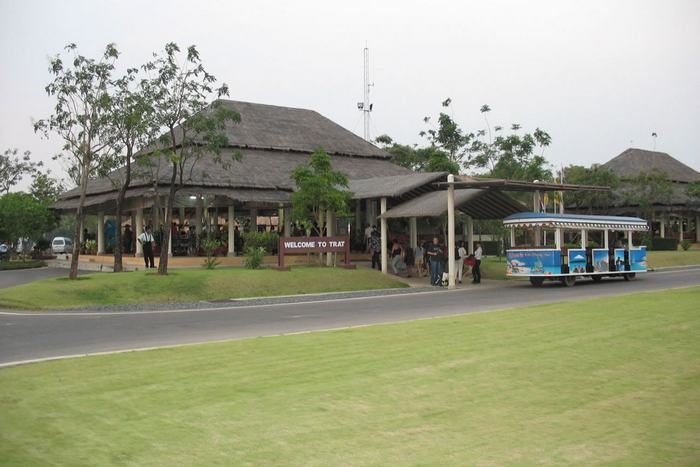
Trat Airport (TDX) is in Khao Saming district, and it is owned and operated by Bangkok Airways, which flies the route from Bangkok. It opened in 2003 and is the third public airport the airline owns and runs. The airport is open from 06.00 to 22.00.
The runway is 1,800 metres by 45 metres, and Thailand's Aeronautical Information Publication records no taxiway, with aircraft parking on the runway itself. The terminal and the transfer out to the ferry piers are covered on the Trat Airport page, and the typical schedule for flights from Bangkok is on the Bangkok to Trat route page.
Getting out to the islands
Ao Thammachat is the working vehicle crossing to Ko Chang, landing at Ao Sapparot on the island's north-east coast, and it takes cars as well as foot passengers. Laem Sok is the pier Boonsiri Ferry sails from for Ko Kut and Ko Mak.
Centrepoint at Laem Ngop, latterly branded Trat Ferry, is nearer to Trat town. The operator's own site for the Ao Thammachat crossing says Centrepoint suspended its services in July 2024 and has not resumed, and Boonsiri Ferry described it as still out of service in an article dated October 2025. If an older guide or a hotel sends you to Laem Ngop for the Ko Chang boat, check before you go.
Sailings on the Ao Thammachat route are timetabled through the day, but the operator's site says they leave only once they are full. That is worth allowing for if you are connecting to a flight at either end.
Boonsiri Ferry and the Ao Thammachat operator list these piers.
| Island | Mainland pier | Island pier |
|---|---|---|
| Ko Chang | Ao Thammachat | Ao Sapparot |
| Ko Mak | Laem Sok | Ao Nid |
| Ko Kut | Laem Sok | Ao Salad |
Ko Chang
Ko Chang lies about 8 kilometres off Laem Ngop. It runs roughly 30 kilometres north to south-east, is about 14 kilometres wide, and it is mountainous, with Khao Yai reaching 743 metres. The Department of National Parks names its waterfalls as Than Mayom, Khlong Phlu, Khlong Nonsi, Khiri Phet and Khlong Nueng.
The sand beaches are on the west coast, where the Tourism Authority of Thailand names Hat Sai Khao, Hat Kai Muk, Hat Ta Nam and Laem Bang Bao, all linked by a single road. The east coast has narrow beaches of mud and rock.
The national park does not cover the whole island. Part of Ko Chang is inhabited land in Ko Chang district, outside the park boundary.
Ko Kut and Ko Mak
Ko Kut is the southernmost island of the Ko Chang chain, and the Tourism Authority of Thailand describes it as Thailand's fourth largest. The same page names the waterfalls at Khlong Chao and Khlong Yai Ki, and Khao Ruea Rop, among its sights, and calls Trat Airport the most convenient airport for reaching the island.
It also says there are no banks or cash machines on Ko Kut, so deal with cash before you leave the mainland. Ko Mak, in the same chain, is served from Laem Sok, landing at Ao Nid.
Mu Ko Chang National Park
The park was declared in 1982, Thailand's 45th national park. It covers 650 square kilometres across more than 40 islands in the Ko Chang and Ko Kut minor districts, and about 458 square kilometres of that, roughly 70 per cent, is sea. The Department of National Parks publishes its own record for the park.
Coral is recorded around Ko Chang Noi, Ko Yuak, Ko Man Nok, Ko Khlum, Ko Wai, Ko Laoya, Ko Ngam, Ko Rang and Ko Kra, and around two sunken Thai naval vessels near Ao Salak Phet. Those two wrecks, the Chonburi and the Songkhla, went down in an action east of Ko Chang on 17 January 1941 in which three Thai vessels engaged seven French warships.
A department survey made in 1992 recorded 29 mammal species and 74 bird species in the park, along with 42 amphibians and reptiles. One of them is a frog the department records as found only in the moist evergreen forest of Ko Chang and its neighbouring islands.
What the park has closed
The National Park Office publishes one combined closure table for the whole park system, and its Mu Ko Chang rows were dated 7 September 2026. Ko Thong Lang, Ko Kra and Ko Thian are listed as closed indefinitely, and a coral restoration area at Ko Yak Yai is listed as temporarily closed to scuba diving from 11 November. The same table carries a long hiking trail on Ko Chang, closed annually from 1 June to 31 October.
Unlike Mu Ko Similan and Mu Ko Surin, Mu Ko Chang carries no whole-park seasonal closure in that table.
Check the National Park Office's current closure table before planning a dive, a camp or a long walk on any of these islands.
When to go
The Department of National Parks gives the park three seasons: rain from May to October on the south-west monsoon, cooler weather from November to February on the north-east monsoon, and hot weather in March and April. Average annual rainfall is about 4,700 millimetres and the average annual temperature is around 27 degrees Celsius.
The Tourism Authority of Thailand says boat service to Ko Kut is reduced in the low season. Build slack into any plan that puts an island night immediately before a flight.
The border crossing at Hat Lek
Ban Hat Lek is a border crossing into Cambodia. In a travel advisory issued on 30 December 2025, the Tourism Authority of Thailand said that the Ban Hat Lek, Ban Muen Dan and Ban Ma Muang checkpoints remained closed, and that the curfew in Trat had been lifted on 16 December 2025. The Royal Thai Navy said on 2 June 2026 that the Ban Hat Lek checkpoint remained closed.
The UK Foreign, Commonwealth and Development Office (FCDO) advises against all but essential travel to within 20 kilometres of the land border with Cambodia, and its Thailand advice states that land borders and crossings between Thailand and Cambodia continue to be suspended. The FCDO's advice is drawn by distance from the border rather than by province, and neither notice says anything about Ko Chang, Ko Kut or Ko Mak.
Read the FCDO's current Thailand travel advice and the Tourism Authority of Thailand's own advisories before you build any part of a trip around a crossing at Hat Lek.
Malaria advice for Trat province
The United States Centers for Disease Control and Prevention (CDC) lists Trat among the provinces for which it recommends antimalarial medication as well as mosquito-bite avoidance, rather than bite avoidance alone. That list is drawn by province and does not separate the islands from the mainland. Take it to a travel clinic well before you fly rather than settling it yourself.
Frequently asked questions
Which mainland pier do boats to Ko Chang, Ko Kut and Ko Mak leave from?
Ko Chang is served from Ao Thammachat, landing at Ao Sapparot. Ko Kut and Ko Mak are served from Laem Sok, landing at Ao Salad and Ao Nid. Centrepoint at Laem Ngop, which is nearer to Trat town, has been out of service since mid-2024 on both operators' accounts, and Boonsiri Ferry still described it as suspended in October 2025.
What is the difference between Ko Chang and Ko Kut?
Ko Chang runs roughly 30 kilometres by 14, is mountainous, and has its sand beaches along the west coast, linked by a single road; it lies about 8 kilometres off Laem Ngop and is reached from Ao Thammachat. Ko Kut is the southernmost island of the chain, has waterfalls at Khlong Chao and Khlong Yai Ki, and is reached from Laem Sok. The Tourism Authority of Thailand says there are no banks or cash machines on Ko Kut.
When is the wet season in Trat, and what closes?
The Department of National Parks gives the park's rainy season as May to October, with about 4,700 millimetres of rain a year. Mu Ko Chang has no whole-park seasonal closure on the National Park Office's table, but that table lists one long hiking trail on Ko Chang as closed annually from 1 June to 31 October. Ko Thong Lang, Ko Kra and Ko Thian were listed as closed indefinitely on the table dated 7 September 2026.
Can I cross from Trat into Cambodia at Hat Lek?
The Royal Thai Navy said on 2 June 2026 that the Ban Hat Lek checkpoint remained closed, and the Tourism Authority of Thailand's advisory of 30 December 2025 had listed it as closed. The FCDO's Thailand advice says that land borders and crossings with Cambodia continue to be suspended. Check the FCDO's advice and the Tourism Authority's advisories before you plan around a crossing.
What is on the Trat mainland?
The mainland is where you arrive and where you catch a boat: the airport is in Khao Saming district, and the piers in service on both operators' accounts are Ao Thammachat and Laem Sok, with the suspended Centrepoint pier at Laem Ngop. The Tourism Authority of Thailand names the Ban Nam Chiao community among the province's highlights. Ban Hat Lek, a border crossing into Cambodia, was still closed on the Royal Thai Navy's account of 2 June 2026.