!
Latest updates
How to Get to Koh Lanta: Flights, Roads and Ferries
Updated 8th Sep 2026
Things to Do on Koh Lanta: Diving, Old Town and the National Park
Updated 8th Sep 2026
Krabi Province Guide: Airport, Krabi Town and Choosing a Base
Updated 8th Sep 2026
Thailand for couples: which islands and parks close, and when
Updated 8th Sep 2026
Thai domestic flight tickets: fare rules, baggage deadlines and passenger rights
Updated 8th Sep 2026
Pai Destination Guide
Updated 8th Sep 2026
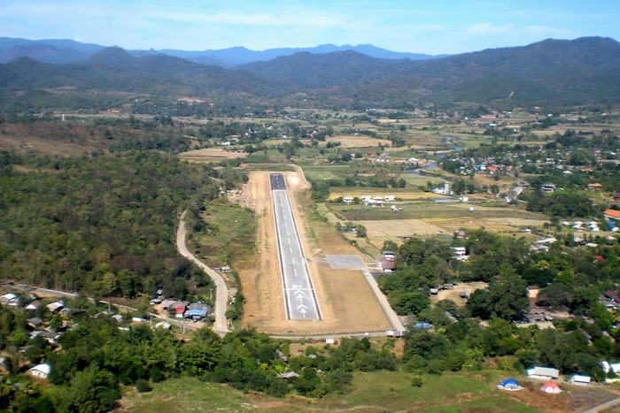
Pai is a district of Mae Hong Son province in northern Thailand, in a valley on the Pai river. There is an airport in the district, and the Department of Airports' own flight records show no scheduled service using it through 2025 or the start of 2026. The practical route is a flight into Chiang Mai and a road journey from there.
For Mae Hong Son town and the rest of the province, see the Mae Hong Son destination guide.
Can you fly to Pai?
The Department of Airports' flight records show no scheduled service at Pai through 2025 and the first two months of 2026. Pai Airport is run by that department and sits in Wiang Tai, in Pai district. Pai is one of the airports in the department's own flight data, and those records show no aircraft movements of any kind there across the whole of 2025.
Six movements appear in January 2026, three arrivals and three departures. All six were filed as business or executive aviation rather than as scheduled service, all on a Cessna 208, and between them they carried fifteen passengers. Chiang Mai was the airport at the other end of the arrivals.
Those records run to 28 February 2026 and say nothing about the months after that. Nothing in them is a service a passenger could book. The airport itself, its facilities and its contact details are covered on the Pai Airport page, and the Department of Airports keeps its own page for the airport.
Getting to Pai from Chiang Mai
Chiang Mai Airport is where people arrive by air for Pai, and it was the airport at the other end of the arrivals Pai recorded in January 2026. The Bangkok to Chiang Mai route page covers that first leg, and the Chiang Mai flights guide covers the airlines that serve the airport.
From Chiang Mai the rest of the journey is by road, on Highway 1095, which the Department of Highways registers as 204 km from Nong Khong to Mae Hong Son and not from Chiang Mai itself. The road is winding and steep, and a road service runs between the two; the timetable is worth checking before you plan the rest of the day. There is a Chiang Mai destination guide if you are staying the night before the road leg.
The climate, and the smoke season
The Department of National Parks gives the climate of Huai Nam Dang National Park, which covers part of Pai district, as cool all year at an average of about 20 degrees Celsius. From October to February the park's average minimum is about 8 degrees Celsius, and in March and April its average maximum is about 23 degrees. Pack something warm for the evenings.
Northern Thailand has a smoke season in the first months of the year, and Pai sits in a valley. In 2026 a national prohibition on burning agricultural land ran from 1 February to 31 March, imposed by the Ministry of Agriculture and Cooperatives, and anyone breaking it lost eligibility for state assistance for two years. Those were the 2026 dates rather than a standing calendar, so check the dates for the year you are travelling.
The Pollution Control Department's national monitoring network has one station in Mae Hong Son province, at the provincial natural resources and environment office in Mueang Mae Hong Son district. There is no station in Pai in that network, so a reading labelled Pai does not come from it.
What there is in Pai
Pai Canyon
The Tourism Authority of Thailand (TAT) calls Pai Canyon the most popular sunset spot in Mae Hong Son province. It is red sandstone, cut by erosion into narrow passageways you can walk along, and a five-minute path through teak forest reaches the highest viewpoint. The sunset is framed by the mountain range west of Pai.
TAT's 2020 guidance for the canyon describes the paths as having razor-sharp edges, with drops as high as 50 metres, tells visitors to wear proper shoes, and suggests coming in the morning to avoid the crowds. The views can be had from the wide open space at the arrival point without walking out along the ridges at all.
The hot springs
Tha Pai hot spring is in Mae Hi, inside Huai Nam Dang National Park. It has two large pools and several smaller seeps spread across a wide area of teak forest, some stretches wide enough to sit in and others that only take feet. Some pools reach 80 degrees Celsius, and the park's welfare shop sells eggs to boil in them.
TAT's advice for the springs is worth following: soak for no more than 10 to 15 minutes at a time, and anyone with a condition such as diabetes with peripheral numbness, or high blood pressure, should consult a doctor before soaking. Camping is allowed, and TAT says to contact the park in advance. An entry charge applies, and a private resort at the entrance offers hot-spring bathing in a private setting.
Sai Ngam hot spring is inside the Lum Nam Pai Wildlife Sanctuary, a protected area a short distance from Pai, about 3 km along a winding mountain road past the sanctuary's main checkpoint. Its pools are terraced, lined with river rocks and shaded by forest, fed by a natural mineral spring, with rustic bamboo changing rooms and lockers.
TAT says Sai Ngam's remoteness makes it less frequented than Tha Pai, which is closer to town. You pay to enter the sanctuary, and again at the springs.
Huai Nam Dang National Park
Huai Nam Dang was gazetted in 1995 as Thailand's 81st national park. It covers about 1,252 square kilometres, taking in Mae Taeng, Chiang Dao and Wiang Haeng districts of Chiang Mai province as well as Pai district, and its land runs from 400 metres to 1,962 metres at Doi Chang, its highest peak. It is the headwater forest of the Mae Taeng and Pai rivers.
Its best-known feature is the sea of mist at the Huai Nam Dang viewpoint, which is where people go for sunrise, and it has a natural hot spring at Pong Dueat. The park headquarters is not in Pai: it is at Kuet Chang in Mae Taeng district, on the Chiang Mai side. The Pai-district parts of the park are the tambons of Wiang Nuea, Mae Hi and Mae Na Toeng.
The town, the bridge and the temple
Pai's walking street runs along Chaisongkhram Road and is at its busiest at night, filling up from about 6pm. The stalls are mostly souvenir T-shirts, scarves and gifts, with restaurants and nightlife along the same street.
Pai Historic Bridge was used by the Japanese army during the Second World War as a route for moving supplies and weapons towards Burma. Visitors now walk out on to it for the views of the Pai river and for photographs.
Mo Paeng waterfall is a few kilometres from the town. Wat Phra That Mae Yen stands on a hill near Ban Mae Yen, with a chedi and a panoramic view over Pai town.
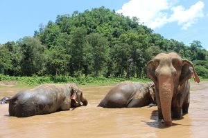
An elephant camp operates in Pai and offers riding and bathing sessions.
Frequently asked questions
How do I get to Pai?
Fly into Chiang Mai and travel the rest of the way by road, on Highway 1095, which the Department of Highways registers as running from Nong Khong to Mae Hong Son and not from Chiang Mai itself. The road is winding and steep, and a road service runs between Chiang Mai and Pai.
What is the nearest airport to Pai?
Pai Airport is in Pai district itself, but the Department of Airports' flight records show no scheduled service using it through 2025 and the first two months of 2026. Chiang Mai Airport is where people arrive by air for Pai, and it was the airport at the other end of the arrivals among the six business-aviation movements Pai recorded in January 2026.
Can you fly from Chiang Mai to Pai?
Not on a scheduled service, going by the Department of Airports' own flight records. Pai recorded no movements at all in 2025, and the six it recorded in January 2026 were filed as business or executive aviation and carried fifteen people between them. Those records end on 28 February 2026.
When is the smoke season in Pai?
Northern Thailand's smoke season falls in the first months of the year. In 2026 a national ban on burning agricultural land ran from 1 February to 31 March, and those dates were set for that year rather than fixed. Check the dates for the year you are travelling before booking a February or March trip.