!
Latest updates
How to Get to Koh Lanta: Flights, Roads and Ferries
Updated 8th Sep 2026
Things to Do on Koh Lanta: Diving, Old Town and the National Park
Updated 8th Sep 2026
Krabi Province Guide: Airport, Krabi Town and Choosing a Base
Updated 8th Sep 2026
Thailand for couples: which islands and parks close, and when
Updated 8th Sep 2026
Thai domestic flight tickets: fare rules, baggage deadlines and passenger rights
Updated 8th Sep 2026
Ranong Destination Guide
Updated 7th Sep 2026
Ranong is a province on Thailand's Andaman coast, wedged between the mountains and the Myanmar border. It is one of Thailand's wettest provinces: the Thai Meteorological Department (TMD) records 4,168.6 mm of rain a year on its 1991-2020 averages, falling on about 198 days. The province holds four national parks, 62 islands in the Andaman Sea, a hot spring in the town's own district and a permanent land border crossing into Myanmar at Kawthaung, open daily from 06.30 to 24.00.
About 86% of it is mountain. It runs 169 km from north to south and narrows to 9 km at its thinnest point, and it suits someone who wants the parks and the islands and is willing to work around the weather.
Getting there
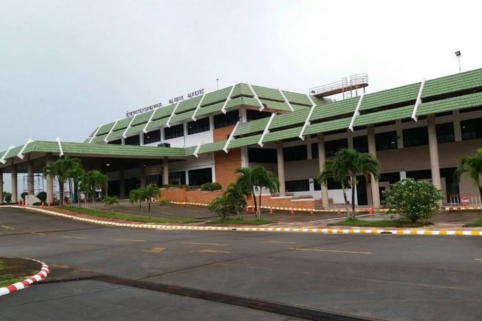
The Department of Airports' flight records for 2025 show one scheduled service at Ranong Airport (UNN): Thai AirAsia, to and from Bangkok Don Mueang, in every month of that year. The airport page carries the detail, including the transfer into town, and the schedules sit on the route pages for Bangkok to Ranong and Ranong to Bangkok.
That single route is also the whole of the airport's scheduled network in those records, so there is no second carrier on the pair to fall back on. The alternative is to drive: Ranong is 568 km from Bangkok on National Highway 4, the Phetkasem Road, and the Department of National Parks puts the journey into the province at about eight to nine hours.
Chumphon Airport (CJM) has Nok Air and Thai AirAsia flying there from Don Mueang in the Department of Airports' records for the same year. It sits on the Gulf coast, on the far side of the peninsula from Ranong, so a detour through it needs a reason.
The rain, and when to go
Rain is the defining fact of the province, and the figures are worth reading before you book. TMD's 1991-2020 averages give 4,168.6 mm a year over about 198 rain days, and August alone averages 766.9 mm across about 26 of its 31 days. The cause is the southwest monsoon, which reaches this coast at full force.
TMD draws those averages from 1991 to 2020, and its record extremes from a longer run, 1951 to 2022, which includes a 24-hour fall of 460.9 mm on 22 June 1970. Six tropical cyclones moved into the province over those 72 years, four of them in November and two in December.
| Season | Months | What it means |
|---|---|---|
| Hot | Mid-February to mid-May | March and April are the hottest months. March averages a daily maximum of 34.7 degrees Celsius, moderated by the sea on a narrow peninsula |
| Rainy | Mid-May to mid-October | The southwest monsoon at full force, with August the wettest month of the year. A low-pressure trough also crosses the south periodically in October |
| Cool | Mid-October to mid-February | The northeast monsoon, with a slight temperature drop because the sea is close. The mountains on the eastern side of the peninsula keep most of that monsoon's rain off this coast |
The drier window is mid-October to mid-February for the cool season and on to mid-May for the hot one. The marine parts of two of the province's national parks also shut over the rainy months, so the weather and the access to the islands run on almost the same calendar. The one closure outside the monsoon is in Namtok Ngao National Park, where the waterfalls and the hot spring shut from 1 February to 31 March, inside that drier window.
The national parks and the islands
Ranong has four national parks: Laem Son, Mu Ko Ranong, Lam Nam Kraburi and Namtok Ngao. The Department of National Parks closes named parts of all four over the course of a year, and those dates decide when the islands and the waterfalls are reachable. Namtok Ngao's closure is the one that falls outside the monsoon.
| Park | What closes | Announced window |
|---|---|---|
| Laem Son National Park | Ko Kamtok, Ko Yi Pun and Ko Khangkhao. Bang Ben beach and the headquarters stay open | 16 May to 14 October |
| Mu Ko Ranong National Park | Ao Khai Tao, the Giant Mangrove and the campground on Ko Chang in Ranong province | 1 May to 31 October |
| Lam Nam Kraburi National Park | The Punyaban Waterfall nature trail | 1 May to 31 October |
| Namtok Ngao National Park | The Namtok Ngao waterfall, the Phon Rang hot spring and Khlong Phrao waterfall. The park's houses and campground are closed indefinitely | 1 February to 31 March |
The department reissues these closures each year, so they are announced for one season and are not a permanent calendar. The windows above are those in the annex to the department's announcement of 18 December 2025 for the 2026 season, published in the Government Gazette on 9 January 2026. Check the current season with the park office before you travel.
Laem Son National Park
Laem Son covers 315 square kilometres across the Mueang, Kapoe and Suk Samran districts of Ranong and Kuraburi district in Phang Nga. It was gazetted as Thailand's 46th national park in volume 100, part 135 of the Government Gazette, dated 19 August 1983. The Department of National Parks names Bang Ben, Thale Nok, Prapas and Ao Khei among its beaches, and Ko Kamtok, Ko Khai Yai, Ko Khangkhao and Ko Yi Pun among its islands.
This is a sunken coastline, so the beaches are narrow, and sediment carried down the Lat Not, Khanut and Bang Ben canals feeds a mangrove swamp forest. A 1995 survey recorded 138 bird species in the park. The department's own page for Laem Son lists the nature trails, viewpoints and snorkelling, and the park's welfare shop opens daily from 08.30 to 16.30.
Under the announcement dated 20 December 2024, tourism and overnight stays on Ko Kamtok, Ko Yi Pun and Ko Khangkhao stopped from 16 May to 14 October 2025, under section 20 of the National Park Act. Bang Ben beach, the headquarters and the park office stayed open throughout. There is an entrance fee, and the department asks visitors to keep the receipt for inspection.
Mu Ko Ranong National Park
This park was gazetted as Thailand's 119th national park in volume 126, part 96 A of the Government Gazette, dated 23 December 2009, under the name Mu Ko Phayam National Park, and the Department of National Parks renamed it Mu Ko Ranong on 23 February 2010, so listings and maps carrying both names are describing the same place. Its headquarters is in Tambon Ngao, about 14 km from Ranong on Highway 4 towards Takua Pa and then about 4 km along the Ban Lang to Hua Thanon road.
The park's coastal islands include Ko Bang Chak, Ko Yio, Ko Sai Dam and Ko Son. Offshore it holds Ko Chang, Ko Phayam, Ko Thalu, Ko Ta Khrut, Ko Mo, Ko Pring, Ko Rai and Ko Fai Mai; Ko Phayam is inside the park, and the department lists Tambon Ko Phayam as one of its four subdistricts. The Ko Chang in that list is the one in Ranong province, not the larger, better known Ko Chang in Trat province.
Hat Hin Ngam on Ko Fai Mai is a beach of round coloured pebbles. Hat Sai Dam on Ko Sai Dam is black sand, formed over a long period from decayed wood and mangrove leaves, and Laem Makham nearby has a 4 km mangrove nature trail. Hat Sai Daeng is brick red, formed from decayed shells.
The Tourism Authority of Thailand's advice for reaching these islands is to contact the park about renting a boat, and for Hat Sai Daeng to carry on to Tha Ton Son and rent one from the villagers, about 35 minutes across. For this park, that means arranging the crossing locally rather than booking it ahead.
Ko Phayam
Ko Phayam is its own subdistrict of Mueang Ranong, reached by boat from the Pak Nam Municipality Pier in Mueang district. Islanders live from cashew and rubber plantations and from coastal fishing, and the island is known for its cashew nuts and its long white sand beaches.
Ao Mae Mai, on the sunrise side in the east, holds the main port, with accommodation, shops, bicycle hire and motorcycle taxis. Wat Ko Phayam stands at the foot of a hill on the beach there, with a cement bridge running out to sea to an ordination hall.
Ao Khao Khwai, on the sunset side in the west, is curved like a buffalo horn, with the Hin Talu rock formation in the middle of the bay and a Moken village to its south. Ao Yai, also on the west, is the island's widest and longest bay at 3 to 4 km. It faces open sea, the waves run higher there than elsewhere on the island, and it is used for surfing.
Raksawarin Hot Springs
The Ministry of Tourism and Sports' tourism directory, which attributes this entry to the Thailand Digital Tourism Center and flags it as not official information, lists the Raksawarin Hot Springs, in Bang Rin subdistrict of Mueang Ranong district, as open every day from 05:00 to 21:00 with no admission charge, and there is a public park beside them. The water runs at about 65 degrees Celsius and carries no sulphur, so there is no sulphur smell. There are three cement pools, the largest 2.80 m across, and carbon dioxide bubbles up through all of them.
Crossing to Kawthaung
Ranong faces Kawthaung in Myanmar across the Pakchan estuary. Myanmar classifies it as a land border checkpoint, but there is no bridge. Thai Customs designates four water checkpoints for the permanent Ranong-Kawthaung crossing and gives its hours as 06.30 to 24.00, so the crossing itself is made by boat.
Myanmar's Ministry of Immigration and Population lists four ports of entry where an electronic visa (eVisa) is valid: the international airports at Yangon, Mandalay and Nay Pyi Taw, and the Kawthaung International Land Border Checkpoint. Kawthaung is the only land crossing on that list. An eVisa cannot be used to arrive by sea, so cruise arrivals need a visa arranged in advance.
The tourist eVisa's approval letter is valid for 90 days from issue, and the stay it grants is 28 days from arrival. It is single entry, so a second crossing needs a second visa, and the ministry asks for a minimum of three working days to process an application. A passport needs at least six months of validity, and the application takes a recent colour photo, the passport bio-data page, proof of a return ticket and proof of booked accommodation.
The ministry adds one requirement specific to this crossing: an applicant entering at the Kawthaung land border checkpoint is asked to attach a trip plan. Tourists are also required to stay in registered accommodation.
Thai visa rules are a separate question. The guide to Thai tourist visas and visa runs covers which visa you hold, how long you may stay on it and what re-entry does to that.
The UK Foreign, Commonwealth and Development Office advises against all but essential travel to the part of Tanintharyi Region south of Tanintharyi township, which is where Kawthaung sits. Advice of this kind changes, so read the current version before planning a crossing.
Frequently asked questions
What is there to do in Ranong?
Four national parks, the islands off the Andaman coast, the Raksawarin Hot Springs in Mueang Ranong district, and the border crossing to Kawthaung in Myanmar. Laem Son and Mu Ko Ranong hold the coastal islands and beaches, Lam Nam Kraburi has Punyaban Waterfall, and Namtok Ngao has waterfalls and a hot spring. The department closes named parts of all four in the windows it announces each year: the marine parts of the first two over the southwest monsoon, and Namtok Ngao's waterfalls and hot spring in February and March.
When is the driest time to visit Ranong?
Mid-October to mid-February, the cool season, when the mountains to the east keep most of the northeast monsoon's rain off this coast. The hot season that follows, mid-February to mid-May, also sits outside the wet months, but Namtok Ngao's waterfalls and hot spring are shut from 1 February to 31 March. Rain falls on about 198 days of an average year in Ranong, so even the better months are not dry ones.
Do I need a visa to cross from Ranong into Myanmar?
Myanmar requires a visa at the Kawthaung crossing. Its Ministry of Immigration and Population lists the Kawthaung International Land Border Checkpoint among four ports of entry where an eVisa is valid, and it is the only land crossing of the four. The tourist eVisa is single entry, grants a 28-day stay and asks for a trip plan when the entry point is Kawthaung; for the Thai side of the question, see the guide to Thai tourist visas and visa runs.
Is Ko Chang in Ranong the same island as Ko Chang in Trat?
No. The Ko Chang in Ranong province is one of the offshore islands of Mu Ko Ranong National Park, and its campground closes over the monsoon months in the window announced for that season. The larger and better known Ko Chang is in Trat province.