!
Latest updates
How to Get to Koh Lanta: Flights, Roads and Ferries
Updated 8th Sep 2026
Things to Do on Koh Lanta: Diving, Old Town and the National Park
Updated 8th Sep 2026
Krabi Province Guide: Airport, Krabi Town and Choosing a Base
Updated 8th Sep 2026
Thailand for couples: which islands and parks close, and when
Updated 8th Sep 2026
Thai domestic flight tickets: fare rules, baggage deadlines and passenger rights
Updated 8th Sep 2026
Surat Thani Destination Guide
Updated 6th Sep 2026
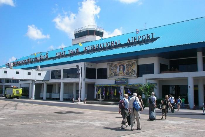
Surat Thani is a working provincial town on the Tapi River in southern Thailand. This page covers what it holds as a place in its own right: the riverfront, the old temple town of Chaiya, and Khao Sok National Park inland to the west.
What Surat Thani is, and who passes through it
Surat Thani is the capital of the province of the same name. The name translates as city of good people. Rubber and coconut are the province's main agricultural exports, with fishing and forestry alongside them, and the province works as a commercial centre for the plantations around it.
Many travellers passing through are heading for Koh Samui, Koh Phangan or Koh Tao, and the islands themselves are covered on the Koh Samui destination guide. The town is not built around that traffic. The three places this page covers lie some way apart: the riverfront is in the centre, Chaiya is about 60 km north, and Khao Sok National Park is inland to the west.
The riverfront: Ko Lamphu and the Chak Phra festival
Ko Lamphu is an island in the Tapi River about 9 km from the river mouth, joined to the mainland by a bridge near the City Pillar Shrine. It is mostly flat and about 0.75 km long, with a small park and food vendors. It is walkable from the town centre.
The same stretch of river carries the Chak Phra festival each October, which marks the end of Buddhist Lent, or Ok Phansa. Boats decorated as mythical creatures are paraded from more than 100 temples, and long-boat races run on the Tapi around the riverbank and Naris Bridge. Ko Lamphu hosts the Thot Phapa and Chak Phra ceremonies themselves.
The festival moves with the lunar calendar, so it does not fall on the same October dates two years running. If you are travelling to see it, confirm the year's dates before you book anything.
Chaiya: the temple, the museum and Suan Mokkh
Chaiya is a district about 60 km north of the town on Route 41. Wat Phra Borommathat Chaiya is the main reason to go: its chedi dates from the Srivijaya period, roughly the 8th to 9th century, and the temple is a national historic monument. The Chaiya National Museum stands on the same site and holds Srivijaya-era pieces, including part of an Avalokiteshvara Bodhisattva sculpture from the temple.
The museum's opening days are reported as Wednesday to Sunday, 09:00 to 16:00. Confirm that before you set out: a 60 km drive to a closed door eats a day you were going to spend somewhere else.
Wat Suan Mokkh, also written Suan Mokkhaphalaram, sits in the same district and asks something different of a visitor. It is a working forest monastery and meditation centre founded in 1932, and its International Dharma Hermitage runs retreats lasting ten days. Ten days is a commitment, and worth knowing before you put the place on a list beside the temple and the museum.
Khao Sok National Park and the Rajjaprabha reservoir
Khao Sok National Park lies in the west of the province, in Ban Ta Khun district, well inland from both the town and the coast. It was announced on 22 December 1980 as Thailand's 22nd national park and now covers 738.74 square kilometres after a boundary change in 1994. The Department of National Parks, Wildlife and Plant Conservation (DNP) runs it and describes it on its own page for the park as the largest remaining area of virgin rainforest in southern Thailand.
Inside the park is the Rajjaprabha reservoir, written Ratchaprapha in some places and also called Chiew Larn or Cheow Lan, with limestone islets standing out of the water. Its size depends on which body is measuring and what they are measuring: DNP puts the scenic zone around the dam at roughly 168 square kilometres, while the Electricity Generating Authority of Thailand (EGAT), which operates the dam, gives the reservoir as 185 square kilometres. Floating raft houses on the water are a working form of accommodation out there.
The dam is a rockfill structure with a clay core, 94 m high, with a crest 761 m long. Construction began in February 1982 and finished in September 1987, and EGAT's own page for the dam gives its contracted generating capacity as 240 megawatts.
Khao Sok is a trip in its own right. It sits inland to the west, while the main piers for the islands are east of the town, so the two lie in opposite directions from the town.
Moving on from Surat Thani
Flights land at Surat Thani Airport, and that page covers the airlines that serve it, the terminal and the combined bus-and-boat services onward. The Bangkok to Surat Thani route page carries the schedule for that leg.
The main ferry piers for the islands are in Don Sak district, on the coast east of the town. How the flight and the boat fit together, and which pier a given service uses, is set out on the Koh Samui flights guide.
Frequently asked questions
Is Surat Thani worth visiting in its own right?
Surat Thani earns a stop more for the province around it than for the town centre. The province is a commercial hub for its rubber and coconut plantations, and what the town itself offers a visitor directly includes the river, Ko Lamphu and, in October, the Chak Phra festival. Chaiya to the north and Khao Sok to the west are stronger reasons to stay a night, and both need transport and a day of their own.
What is there to do in Surat Thani in a day?
In the town, the Tapi riverfront and Ko Lamphu are walkable, reached by the bridge near the City Pillar Shrine. With transport, Chaiya is about 60 km north on Route 41 and pairs a Srivijaya-era temple with a national museum on the same site, so check the museum's opening days first. Khao Sok and the Rajjaprabha reservoir lie the other way, inland to the west, and are worth an overnight stay.